
Search Susquehanna Township Streets
A street-by-street search in Susquehanna Township begins with the literal site address, then moves through records that describe different parts of the same place. The Dauphin County property roll supplies the parcel and tax-card context. The Recorder connects that parcel to recorded transfers. Historic directories may add an occupant or business for a particular published year. These sources cannot be collapsed into one claim about a current household, but they can form a careful address history.
Use the same sequence for one address or for a short street segment. Keep the search terms exactly as each record displays them. A Harrisburg mailing label can occur on a Township parcel, and an older road name can be the reason an exact search fails. The parcel number, also called a UPI or PIN, is the steadier bridge when a street name or number has changed.
- Search the address in the Dauphin County Property Tax Inquiry. For a segment, enter Street Name with House Number Low and High, then select
62 - SUSQUEHANNA TWP. - Save the parcel number, site address, owner and mailing fields, tax year, and sale-history document number. These are parcel and tax-contact facts, not a list of people at the site.
- Enter the address or Tax Parcel ID in the Susquehanna Township Zoning Map to place the parcel and view its zoning context.
- Use the parcel, document number, legal description, or recorded party in Recorder Acclaim to examine the deed and plan trail.
- For a voter-record question, ask Dauphin County Elections about the controlled street-list inspection or copy process and its required use certification. The individual status form is not a street browser.
- For a historical household question, check whether a Harrisburg directory volume has a street-number section, then pair that result with census and newspaper evidence for the same era.
Note: The public voter status form checks an individual registration request; it is not a browseable Susquehanna Township street directory.
Susquehanna Township Parcel Search
The County Property Tax Inquiry is the strongest first stop for the current address layer. Its Street Name and low/high house-number fields allow a whole-street segment query, while the municipality filter includes 62 - SUSQUEHANNA TWP. The portal also permits parcel number, owner name, sale-range, neighborhood, building, and property-class filtering. Owner Name is useful when a deed supplies a party, but it is not a current-residency search.
| Devnet field | How to use it by street | What it returns |
|---|---|---|
| Street Name | Enter the site-address road name. | Parcels matching that street. |
| House Number Low / High | Set a number range for a short segment. | Parcel cards in the selected range. |
| Townships/Municipalities | Select 62 - SUSQUEHANNA TWP. | A County query narrowed to the Township. |
| Parcel Number | Reuse the UPI from a card or deed. | A durable parcel match across records. |
| Owner Name | Use a recorded party as a lead. | Tax parcels associated with the query. |
The County parcel-card sample shows the kinds of panels a public municipal parcel can display, including site, owner/mailing, sales-history, assessment, related-name, and property-image areas.
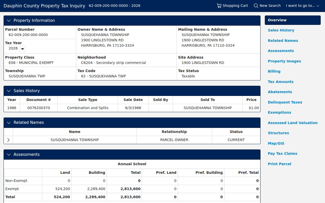
Read Site Address and Mailing Name & Address separately. The first locates the taxable parcel; the second tells the County where notices are sent. A match or mismatch between them does not prove who occupies the address. The sample’s Related Names panel likewise labels its relationship as parcel owner, a reason to preserve the portal’s own label instead of recasting it as a household list.
Susquehanna Township Street Map Records
Map work keeps a street-directory result tied to the right piece of ground. The Township zoning map accepts either a property address or Tax Parcel ID. After selecting a parcel, its popup panels lead to the zoning district and ordinance link. The County’s GIS landing page is the broader entry point for interactive maps and open-data resources. It is reference geography, and the County does not promise positional or thematic perfection.
The Dauphin County GIS entry page is the County route to its interactive map and open-data resources.
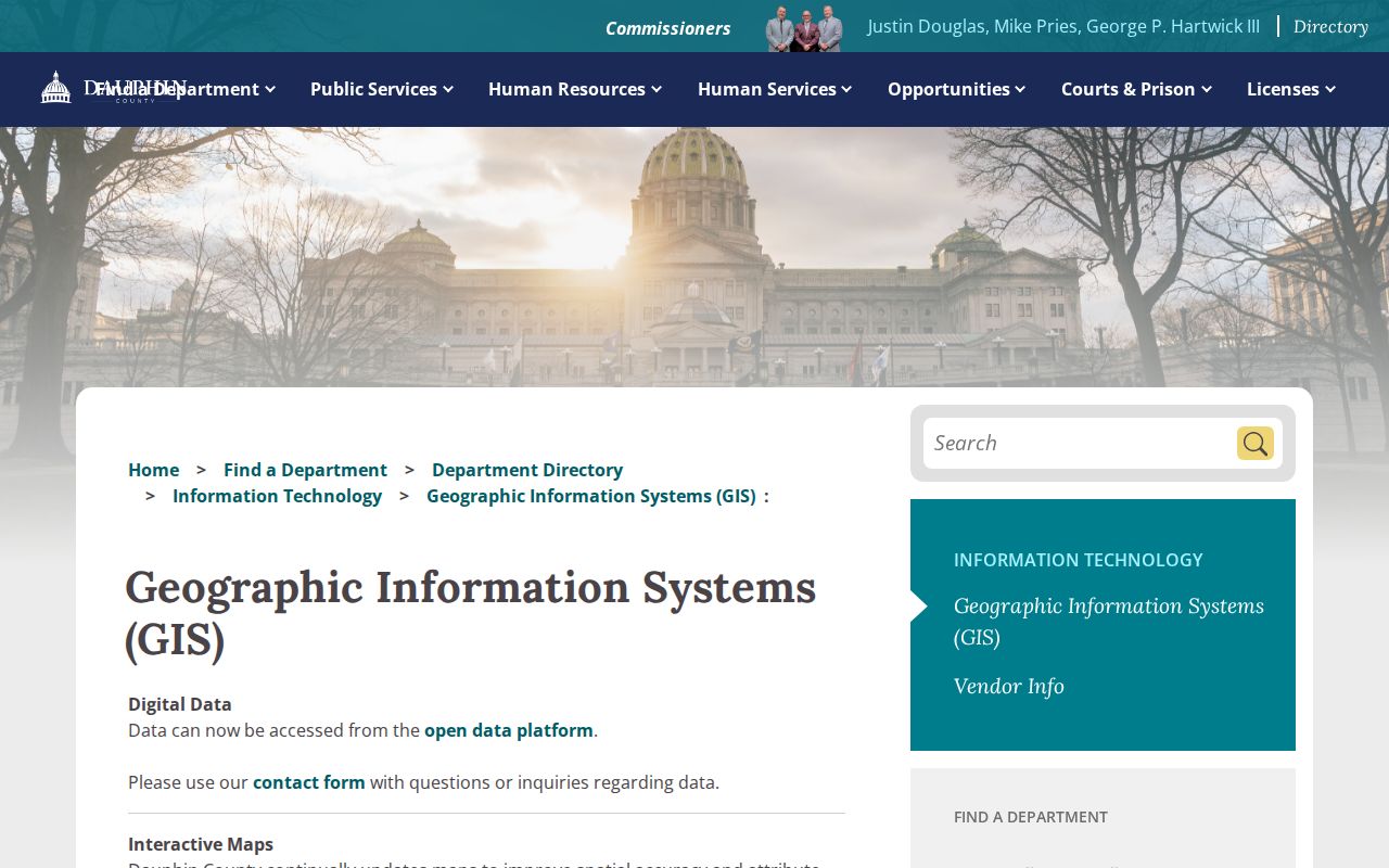
Use GIS to orient a street segment, then return to Devnet for a parcel card and Acclaim for recorded documents. The maps do not promise an owner directory or a complete adjacent-parcel report on their own.
The Township zoning-map instructions show the local address-or-parcel workflow and the parcel-popup path to zoning information.
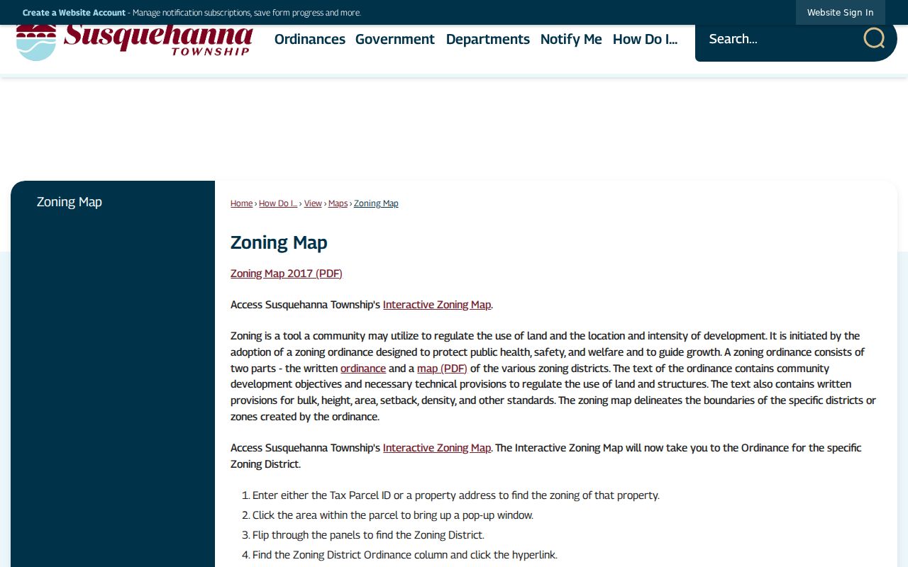
The zoning view is valuable for street geography, but it does not substitute for a tax card, deed, or records request. Pair the map with the parcel number when moving among systems.
Susquehanna Township Address Records
A Susquehanna Township street directory relies on several address-keyed records, each with a narrower purpose. The assessment record maps a parcel to a tax owner and a mailing contact. A deed identifies parties to a recorded transfer. A plan or easement can explain a lot, road, or access pattern. A permit can show an applicant or agent for a known project. The public record is strongest when its field is described exactly, rather than treated as evidence of every person connected to an address.
| Address record | Local keeper | Street-level value | Access path |
|---|---|---|---|
| Property tax card | Dauphin County Tax Assessment | Parcel, site, owner/mailing, class, assessments, sale data. | Free Devnet portal or County office. |
| Parcel and zoning map | County GIS / Township | Parcel position, zoning district, street geography. | County GIS and Township map. |
| Deed, plan, or lien index | Dauphin County Recorder | Recorded parties, legal description, instrument, plan links. | Acclaim search and Recorder counter. |
| Permit or plan file | Township Community Development | Known-address project, site-plan, applicant, or work evidence. | Forms, counter, or a specific RTKL request. |
| Street-list records | Dauphin County Elections | Statutory inspection/copy route, subject to restricted use. | Ask the Elections Office for current procedure. |
A UPI is the County property number for one tract, lot, or parcel. A situs address is the parcel’s physical location. A plat or plan depicts a subdivision or surveyed layout. A criss-cross directory is a volume with an address or street-number arrangement rather than only an alphabetical name list.
- Parcel / UPI
- The durable County key that can join a tax card, map, recorded document, and plan.
- Situs address
- The physical address of the taxable parcel, which can differ from the tax mailing address.
- Plat or plan
- A recorded layout that can preserve a lot, block, subdivision, or road relationship.
- Criss-cross directory
- An address-organized section available only in some historical directory volumes.
Susquehanna Township Street Name Changes
The Township street appendix is an address-research tool, not merely a road list. It records actions, locations, and dates for openings, vacations, acceptances, and renamings. For historical street-directory work, write down an old and current name before searching any index. In 1953, Cherry Street became Herr and Boas Streets, Pine Street became Twenty-sixth Street, and Walter Street became Wilhelm Road. The appendix also records later changes including the 1958 Dauphin Road and 1995 Ararat Boulevard Extension changes.
Search an old directory, a deed comment, and a plan using the literal road label shown in that source. Then use the ordinance chronology to bridge it to the current address. That method prevents a false no-match when a parcel, directory, and postal label use different versions of the same place. A Harrisburg mailing city does not settle Township jurisdiction, so verify the Township field on the County card or the local map.
Note: Street names and parcel keys carry different kinds of continuity, so keep both in the research notes for any old address.
Susquehanna Township Deed Trail
Recorder Acclaim turns an address search into a document trail after the parcel number or sale document is known. Its public modes include Simple Search, Name, Instrument#, Doc Type, Book/Page, Record Date, Consideration, UPI Number, Municipality/Comments, and Alpha Index. For a street, useful document types include deeds, corrected deeds, plans, easements, mortgages, releases, liens, judgments, and name/address changes. The record is a recorded-document index, not proof that a named party remains at the address.
The Recorder states that deeds and miscellaneous documents run from 1785 to the present, while mortgages run from 1979 to the present. Search the correct record stream for the question at hand. Record the grantor, grantee, recording date, instrument or book/page, legal description, plan/lot/block information, and UPI from each relevant hit. The legal description is often more reliable than an older street number.
| Deed | Recorded transfer parties and a legal description of the land. |
|---|---|
| Plan | Lot, block, subdivision, or street-layout context. |
| Easement | A recorded access or use interest that may explain a street or parcel relationship. |
| Mortgage release | A recorded loan event, not by itself a transfer of ownership. |
Dauphin County’s Record Notification Service can send an email when a document is recorded against a property, name, or parcel number. It is a useful monitoring prompt for a known parcel, but the alert should lead back to the actual recorded document.
Susquehanna Township Street Permit Records
Permit and plan records can add a date-specific layer to a Susquehanna Township street search. Township Community Development forms identify property location and may identify an owner, applicant, agent, site plan, work type, and date. No public searchable permit ledger was located, so the practical alternatives are the Township form route, a counter inquiry for a known address, or a written request that sufficiently describes the records sought under the Pennsylvania Right-to-Know Law.
The Township’s permit information notes that Pennsylvania’s 2021 construction codes and amendments took effect January 1, 2026. Treat that as context for present files, not as a date for any particular structure. A permit can document work or an application; it does not replace the parcel card or recorded title trail.
Historic Susquehanna Township Street Listings
Older street-directory evidence comes chiefly from Harrisburg City Directories because Susquehanna Township sits on the capital-city edge. The Historical Society of Dauphin County holds a documented Harrisburg directory run from 1839 through 1999 with named gaps. East Shore Area Library holds Harrisburg City Directories on microfilm from 1861 through 1901. The volumes are not a Township-only run, and not every volume has an address section.
HSDC says some editions have a second listing by street number. Ask whether the year being consulted contains that section before ordering research or reading a full volume. It can connect a known address to an historical occupant or business, while an alphabetical entry can provide a name, address, and usually occupation. The historical collections themselves are described in more detail on the Susquehanna Township directory book page.
For a household trail, preserve the printed street name and number, check spelling variants, and pair the directory year with a federal census snapshot. The 1890 federal population schedule was largely destroyed, making available directories, deeds, and newspapers especially helpful around that gap.
Note: A street-number section is volume-specific, so confirm its presence with the repository before treating a directory as an address index.
Susquehanna Township Street Geography
Postal geography adds another check to a street directory search. Township addresses often use Harrisburg, Pennsylvania as a mailing locality even though the parcel belongs to a separate municipal government. The County card’s Township and tax-code fields, plus the Township zoning or ward maps, are better jurisdiction checks than a postal city label. This matters near the Township’s city, borough, and municipal edges.
Use the official map roster to confirm the physical setting, then keep literal labels from every source: the Harrisburg directory title, the Township parcel code, the mailing ZIP, and an older road alias. One address can be described differently in each system without creating a contradiction.
Limits of a Susquehanna Township Street Search
Ownership, tax-contact, and recorded-party data are not a complete street directory of present households. Devnet can identify an owner and tax mailing address. A deed identifies people involved in a recorded instrument. Neither source supplies every adult or family member at a site. Utility accounts, delivery records, motor-vehicle addresses, protected court material, and confidential-address records do not fill that public-record gap.
Pennsylvania’s individual voter status tool is also not a street browser. State law permits controlled inspection of street lists and regulates copies of public voter information, so contact Dauphin County Elections for the current procedure and any required use certification. The public list excludes electronic signatures and SURE registration numbers. Absence from a voter record cannot establish that someone does not live at an address.
Lawful use. Susquehanna Township address research is appropriate for personal, family, property, and civic questions. Do not use records to stalk, harass, intimidate, or harm another person.